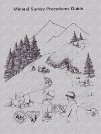
The Mineral Survey Procedures Guide, 1980 opens with a disclaimer that it does not supersede the Bureau Manual or federal, state, or mining district law, immediately establishing its role as a practical supplement rather than an authoritative code. Compiled by retired U.S. Mineral Surveyor John V. Meldrum under the Bureau of Land Management’s Cadastral and Mapping Training Staff, the guide is explicitly designed for mineral surveyors, claim evaluators, and cadastral surveyors retracing original surveys. Its foreword defines mineral surveys as marking legal boundaries of mineral deposits on public domain where lines differ from normal subdivision, blending technical surveying with legal documentation.
Legal Foundations and Interplay of Jurisdictions
The guide’s first chapter, “Mining Laws,” covers mining districts, federal and state laws, and an abstract of state laws, emphasizing the survey-legal interrelationship. The text repeatedly stresses that mineral surveys must align with multiple legal layers: the Manual of Instructions for the Survey of the Public Lands of the United States is the official BLM document, and any contradictions with this guide should be resolved by referring to the Manual. This layered approach reflects the complexity of mining claims, where federal, state, and district laws all apply. The glossary of mining terms and appendix further anchor the procedural content in legal terminology, making the guide a reference for navigating jurisdictional overlaps.
Fieldwork as Negotiation and Evidence Gathering
Chapter V, “The Patent Survey,” details fieldwork that begins with an examination of the property alongside the claimant. The surveyor is instructed to visit claim corners, discovery workings, and underground workings, discussing safety and obtaining maps. Notably, the text advises establishing relations with landowners and other claimants, and if access is refused, to seek help from the U.S. Marshal—but notes that proper handling usually grants permission. The surveyor is told to stress impartiality as a government official and to protect all valid interests. This section reveals that fieldwork is as much about negotiation and trust-building as it is about measurement, with the claimant often providing triangulation networks, aerial photos, and historical records.
Administrative Procedures and Cancellation Protocols
The guide outlines clear administrative steps for survey orders, including cancellation procedures. Section 4–8 specifies that the most common reason for cancellation is the surveyor’s failure to complete and file returns; in such cases, both claimant and surveyor are given 30 days’ notice to explain. Other reasons include a claimant’s request or a claim being declared null and void due to a U.S. contest. A cancelled survey number is never reused unless reopened as an amended survey, marked with “Am.” This meticulous record-keeping underscores the permanence and legal weight of mineral survey numbers, reflecting the guide’s focus on procedural integrity and traceability.
Readers approaching this guide should expect a hybrid document: part technical manual, part legal reference, and part administrative handbook. Its value lies not in narrative but in the precision of its procedures and the clarity of its warnings about jurisdictional overlaps. The guide assumes familiarity with surveying basics and legal concepts, making it most useful for practitioners or researchers studying public land management and mining history. The excerpts suggest a work that prioritizes accuracy and impartiality over expediency, a tone consistent with its government authorship.
Flipping through that old mineral survey guide, I kept thinking of the quiet, precise way it mapped the land’s bones. It felt like remembering a hand-drawn sketch, not a photograph. That same patient attention to detail lives in California illustrated — A Closer Reading, where every line seems to wait for you to look again, slower.